loading
Made up of four levels with rounded corners, its staircase bears human foodprints. It owes its name to the fact that that´s where four Sacbeob or white roads meet. |
Both ballgame courts date back from the Classic period. They have bas-reliefs that represent prisoners. The Group of the Paintings (Group D) also bears glyphs and two markers with the image of a human skull and a beheaded jaguar. |
The Mayan architects used a natural elevation to build the largest structures of the city. Among plazas and patios, Nohoch Mul - 42 meters high -, is the highest pyramid in the Yucatan Peninsula. It is made up of seven bodies with rounded corners and staircases that lead to the temple. The impressive view from the top is a reward for climbing its 120 stairs. |
It belongs to the Eastern Coast style and is associated to Teotihuacan for the use of the slope and panel architectonic element. Its buildings – 3 structures and 13 altars – were built during the late postclassic period (1250-1550 A.D.), with stones from previous buildings. |
The most important network of sacbeob in the Maya World is found in Coba. Its purpose was to unite and control the vast territory in the area. The Coba-Yaxuna road is the longest (100 kms.). Some sacbeob can be traveled on bicycle. |
John L. Stephens first mentioned Coba in 1842. Jose Peon Contreras and D. Elizalde made sketches of the most prominent building in 1886. In turn, Teobert Maler printed the first photograph of the temple that crowns the Nohoch Mul pyramid in 1891. Alfonso Villa would go down the Coba-Yaxuna sacbe in 1933. |
These large buildings outline a plaza divided by three sacbe’ob (“white roads,” Sacbe number 3, 14 and 15). It is known for its structure called the Church (24 meters high), name given to it during the 19th century due to the rituals that were carried out in front of Stela 11, located at its base. Only the upper part of this stela remains (worshipped as the Virgin of Colebi). The platforms of the base were enlarged with walls that formed rounded corners. |
The kingdom of Coba settled around the Coba, Macanxoc, Sacalpuc, Yaxlaguna and Xcanha lagoons. At its peak, this prominent Mayan ceremonial center (Classic and Post-Classic periods) occupied 99 sq km.
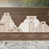
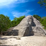
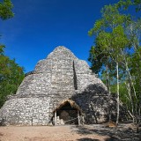
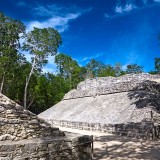
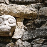
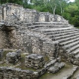
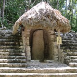
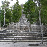
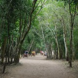
The earliest evidence of Coba dates back to the Classic period (300-900 A.D.), when the stelae we can still admire today were sculpted. Coba is said to have started growing a couple of centuries before Christ, until it reached a population of around 50 thousands inhabitants on an 80 sq. km extension. Most sacbeob (causeways) radiate from the Coba Group to make a strategic network for political and economic expansion. From the 5th to the 10th century, Coba was a storage center that traded with other Mayan cities, namely those on the Caribbean coast. They used the ports of Xcaret, Xel-Ha, Tankah and Tulum.